| Year | Arab | Total |
|---|---|---|
| 1931 * | 2688 | |
| 1944/45 | 3710 | 3710 |
| Year | Arab | Public | Total |
|---|---|---|---|
| 1944/45 | 60560 | 25 | 60585 |
| Use | Arab | Public | Total | ||||||||||||
|---|---|---|---|---|---|---|---|---|---|---|---|---|---|---|---|
|
30163 | 25 | 30188 (50%) | ||||||||||||
|
30397 | 30397 (50%) |
The village was spread along the top of a wide rocky ridge on the western side of the Hebron Mountains. It overlooked Wadi Qubayba to the north and commanded a view of higher mountains to the east. Although the entire area generally sloped down toward the south coastal plain, this was not obvious from the village because hills to the west of it blocked the view of the plain. A secondary road connected al-Dawayima to the village of Idna, to the northeast. Yet another secondary road led from al-Dawayima to al-Qubayba, to the northwest, and this in turn was linked to the al-Faluja-Bayt Jibrin highway.
The site of al-Dawayima has been tentatively identified with the Old Testament village of Bozqat or Bosqat. In the late nineteenth century, al-Dawayima stood on a high stony ridge that had olive groves beneath it. On a higher ridge to the west stood a shrine that was topped by a white dome. ![]()
The people of al-Dawayima were Muslims. They maintained several religious shrines, chief among them the shrine of a Shaykh Ali. This shrine had a large courtyard, a number of rooms, and one large hall for prayers, and was surrounded by fig and carob trees and cactuses. It attracted visitors from neighboring villages. ![]() A mosque was located in the village center; it was maintained by the followers of al-tariqa al-khalwatiyya, a Sufi mystic order founded by Shaykh Umar al-Khalwati, who died in 1397.
A mosque was located in the village center; it was maintained by the followers of al-tariqa al-khalwatiyya, a Sufi mystic order founded by Shaykh Umar al-Khalwati, who died in 1397. ![]() The villagers expanded and renovated the mosque in the 1930s, and added a tall minaret.
The villagers expanded and renovated the mosque in the 1930s, and added a tall minaret. ![]()
The village had a star-shaped layout, which permitted construction to expand in all directions, particularly northeast and northwest along the above-mentioned roads. Shops were scattered throughout the various neighborhoods of the village center. Houses were made of stone and mud, separated by narrow streets and alleys. The older houses were clustered closely together. Each set of houses shared a hawsh, a large courtyard that provided space for women to do their domestic chores, for children to play, and for families to gather in the evening and on special occasions. As the village expanded people began to build new houses outside of the village core. These new houses were larger and built of whitewashed stone some of them had thick, stone walls and were called jidaris (from the Arabic word for wall, jidar). Typically, each of these houses stood apart from the others and did not form part of a hawsh. However, the floor plan of the new houses was the same as that of the old. Each house had two levels: the upper level was occupied by the family members and the lower level by their animals. The houses of the well-to-do villagers had their own courtyards and large guest rooms, in addition to animal stables. ![]()
Al-Dawayima had an elementary school that was opened in the village in 1937. ![]() The villagers obtained part of their drinking water from wells that collected rainwater. In the 1940s they drilled three new wells. During this period they also built numerous cisterns for collecting rainwater.
The villagers obtained part of their drinking water from wells that collected rainwater. In the 1940s they drilled three new wells. During this period they also built numerous cisterns for collecting rainwater. ![]()
Rainfed agriculture was an important basis of al-Dawayima's economy. The chief crops included a variety of grains, especially wheat, barley, and maize vegetables and fruits, especially figs and grapes, were also cultivated. In 1944/45 the villagers allotted a total of 21,191 dunums of their land to cereals; 1,206 dunums were irrigated or used for orchards. The rugged terrain around the village was covered with trees, such as oaks and suwayd (Rhamnus Palestina).
Equally important to the village economy was animal husbandry. There were twenty-seven clans, or hamulas, in the village ![]() , and every hamula owned an average of 200 to 300 head of goats or sheep, and a few camels and cows.
, and every hamula owned an average of 200 to 300 head of goats or sheep, and a few camels and cows. ![]() The villagers pastured their animals on the large blocs of uncultivated land nearby.
The villagers pastured their animals on the large blocs of uncultivated land nearby.
In addition to agriculture and animal husbandry, the villagers engaged in the spinning and weaving of tents and sacks for storing grain. They also tanned hides and wove baskets for the market. ![]() Al-Dawayima had about thirty to fifty small shops, ten butchers, and two grain mills. The economy of the village became more dynamic in 1944 with the introduction of a weekly Friday market. The market brought in residents from other villages and towns, including Bayt Jibrin, Hebron, and Gaza, who traded in produce, clothes, pastry, and other goods. The market was held on the village's threshing floor and was called the suq al-barrayn ('the market of the two terrains') because it was believed to combine the trade of the mountains and the plains.
Al-Dawayima had about thirty to fifty small shops, ten butchers, and two grain mills. The economy of the village became more dynamic in 1944 with the introduction of a weekly Friday market. The market brought in residents from other villages and towns, including Bayt Jibrin, Hebron, and Gaza, who traded in produce, clothes, pastry, and other goods. The market was held on the village's threshing floor and was called the suq al-barrayn ('the market of the two terrains') because it was believed to combine the trade of the mountains and the plains. ![]()
Al-Dawayima was built on an archaeological site. In addition, a large number of khirbas lay in the vicinity. This suggests intense occupation of the area in the past.
Al-Dawayima was the site of one of the larger, little-known massacres of the war. Carried out on 29 October 1948, during the Israeli army's Operation Yoav, the massacre precipitated a massive flight of people from the area, according to Israeli historian Benny Morris. He quotes a participant in the attack on the village as saying that about 80 to 100 people, including women and children, were killed by 'the first wave of conquerors.' The following are excerpts of a description published in the Israeli daily 'Al ha-Mishmar: 'The children they killed by breaking their heads with sticks. There was not a house without dead…. One commander ordered a sapper to put two old women in a certain house… and to blow up the house with them. The sapper refused.... The commander then ordered his men to put in the old women and the evil deed was done. One soldier boasted that he had raped a woman and then shot her….'
Another description of the massacre was given by the former mukhtar of the village, interviewed in 1984 by the Israeli daily Hadashot. The mukhtar recalled: 'The people fled, and everyone they saw in the houses, they shot and killed. They also killed people in the streets. They came and blew up my house, in the presence of eye-witnesses.' The mukhtar added: 'The moment that the tanks came and opened fire, I left the village immediately. At about half-past ten, two tanks passed the Darawish Mosque. About 75 old people were there, who had come early for Friday prayers. They gathered in the mosque to pray. They were all killed.' The mukhtar also said that about thirty-five families were hiding in caves outside al-Dawayima, including some from the previously occupied village of al-Qubayba. When the Israeli forces discovered them, 'They told them to come out and get into line and start to walk. And as they started to walk, they were shot by machine guns from two sides…. We sent people there that night, who collected the bodies, put them into a cistern, and buried them.'
The mukhtar was taken back to the site of his village in 1984 for the first time since the massacre. He showed an Israeli journalist where his home had been, as well as the cistern where the bodies had been buried. A few days later, the journalist returned with four laborers. They dug for a short while and discovered several human bones, including three skulls-one of them a child's. They did not continue digging, but reburied the bones.
Morris writes that a number of investigations were launched into the massacre, but does not mention what they found. They were generally ineffectual and ended with the disciplining of some soldiers and the issuing of a set of rules on treatment of Arab civilians by the Israeli army. The unit responsible for the massacre was the Eighty-Ninth Battalion, which was part of the Eighth Brigade, commanded by General Yitzchaq Sadeh, the founder of the Palmach. Operation commander Yigal Allon told Sadeh to look into the 'rumours,' but his response is not given. ![]()
In December 1948, during a general discussion of atrocities by an Israeli ministerial committee, the issue of al-Dawayima was raised again. Morris writes that Agriculture Minister Aharon Zisling was probably reacting to a letter he received about this massacre, when he said: 'This is something that determines the character of the nation…. Jews too have committed Nazi acts.' Although he complained that the investigation was not proceeding as it should, he agreed with other ministers that Israel should admit nothing outwardly, in order to preserve its image. ![]()
The settlement of Amatzya, founded in 1955, was built on the ruins of al-Dawayima.
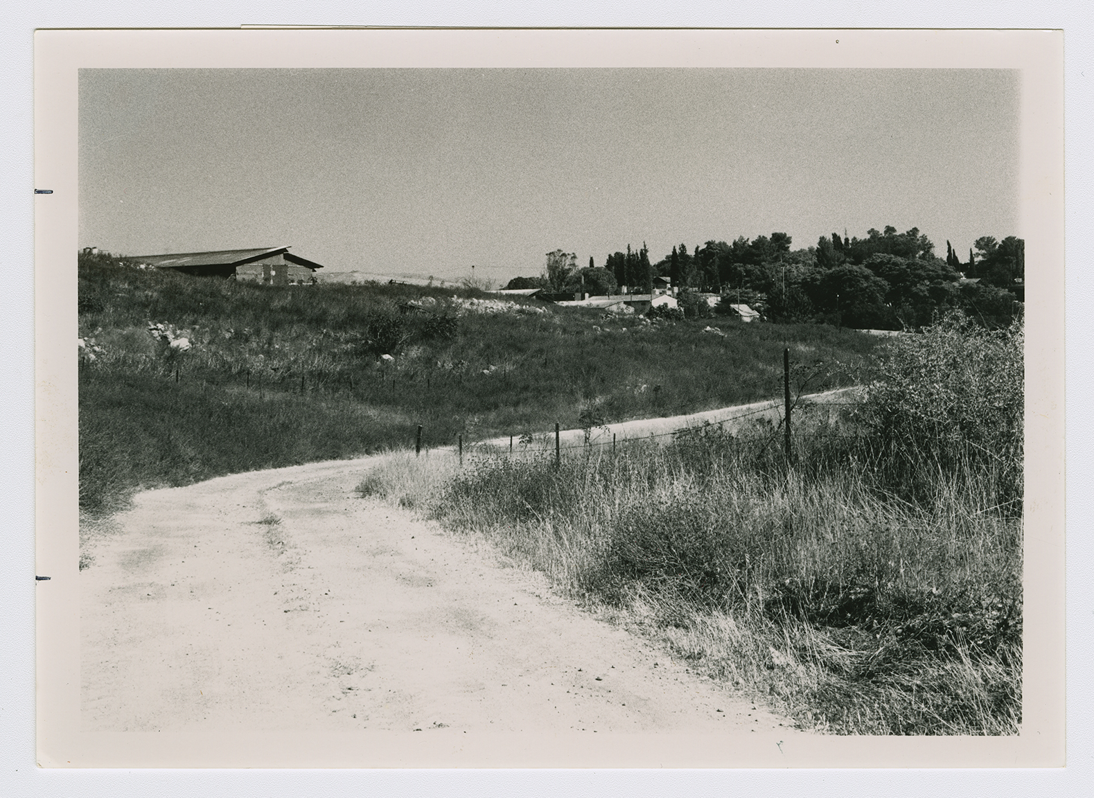
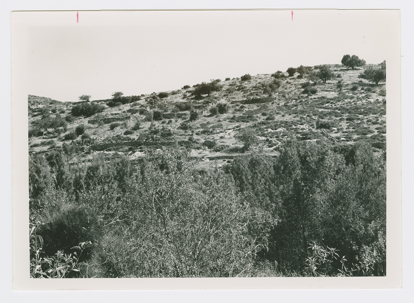
The site has been fenced in. A cowshed, a chicken coop, and granaries have been built at its center (which has been levelled). The southern side of the site contains stone terraces and the remnants of a house. The eastern side is occupied by the residential area of the moshav. Cactuses, together with many carob and olive trees, grow on the site's slopes.
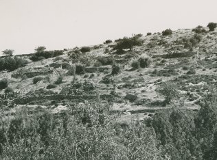
Walls and a single building on the south side of the wadi that divides the village. View from north to south.
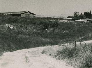
The settlement of Amatzya on one of the two hills on which the village stood. View from west to east.