| Year | Arab | Total |
|---|---|---|
| 1931 | 170 | |
| 1944/45 | 240 |
| Year | Arab | Jewish | Public | Total |
|---|---|---|---|---|
| 1944/45 | 408 | 5170 | 1 | 5579 |
| Use | Arab | Jewish | Public | Total | |||||||||||||||
|---|---|---|---|---|---|---|---|---|---|---|---|---|---|---|---|---|---|---|---|
|
27 | 2723 | 1 | 2751 (49%) | |||||||||||||||
|
381 | 2447 | 2828 (51%) |
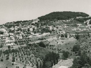
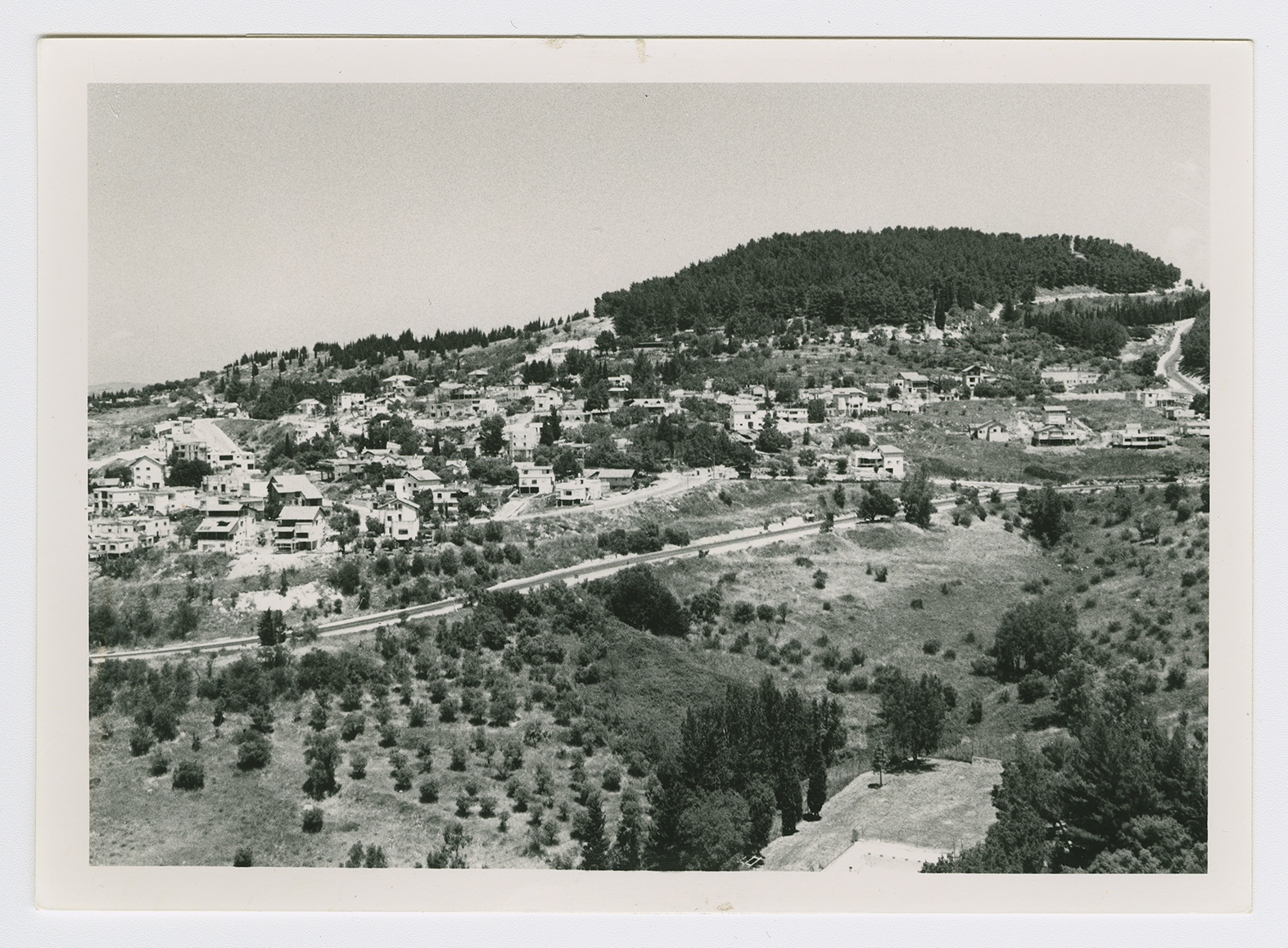
The village stood on the southern slope of a high hill that overlooked the city of Safad, to the south, and faced Mount al-Januaq, to the west. At the bottom of the slope ran a deep wadi. It was separated from Safad by agricultural land that was crossed by a highway; the highway linked Safad with nearby towns and villages. Biriyya may have been -built on the site of the Roman village of Berai or Biri, which was also a Jewish town during the first century A.D. ![]() In 1596, Biriyya was a village in the nahiya of Jira (liwa' of Safad) with a population of 319. It paid taxes on a number of crops, including wheat, barley, and olives, as well as on other types of produce and property, such as goats, beehives, vineyards, and a press that was used for processing either olives or grapes.
In 1596, Biriyya was a village in the nahiya of Jira (liwa' of Safad) with a population of 319. It paid taxes on a number of crops, including wheat, barley, and olives, as well as on other types of produce and property, such as goats, beehives, vineyards, and a press that was used for processing either olives or grapes. ![]()
In the late nineteenth century, Biriyya was a stone-built village surrounded by arable land, with about 100 to 150 (predominantly Muslim) residents. ![]() In modern times, most of its agricultural lands were southeast of the village. In 1944/45 a total of 328 dunums was allocated to cereals and 53 dunums were irrigated or used for orchards. Most of the residents worked in agriculture. They drew water for domestic use and crop irrigation from a number of springs in the vicinity. The villagers relied on Safad for services and for the marketing of their produce.
In modern times, most of its agricultural lands were southeast of the village. In 1944/45 a total of 328 dunums was allocated to cereals and 53 dunums were irrigated or used for orchards. Most of the residents worked in agriculture. They drew water for domestic use and crop irrigation from a number of springs in the vicinity. The villagers relied on Safad for services and for the marketing of their produce.
A skirmish in the vicinity of Biriyya was reported on 7 April, when the Haganah announced to foreign reporters that 20 Arabs had been killed in an engagement near Mount Canaan, outside Safad. No further details are given by the New York Times, but the village may have been involved, since it lay on the mountain slope. ![]()
Israeli historian Benny Morris states that on 1 May 1948, one Palmach squad captured Biriyya, while another force took the adjacent village of 'Ayn al-Zaytun, in preparation for the final assault on Safad. No details are given about the circumstances of the occupation, but judging from the experience of 'Ayn al-Zaytun, the residents were probably forced to leave, and some may have been killed in the process. By taking the two villages, the Palmach managed to establish a link with the Jewish garrison in Safad, facilitating that city's capture. Morris states that the fall of Biriyya had a demoralizing effect on the residents of Safad; according to a New York Times report, they began to evacuate the city following its capture. The occupation of Safad and eastern Galilee was completed in May during Operation Yiftach (see Abil al-Qamh, Safad sub-disctrict). ![]()
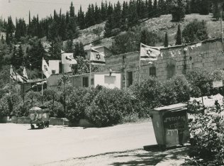
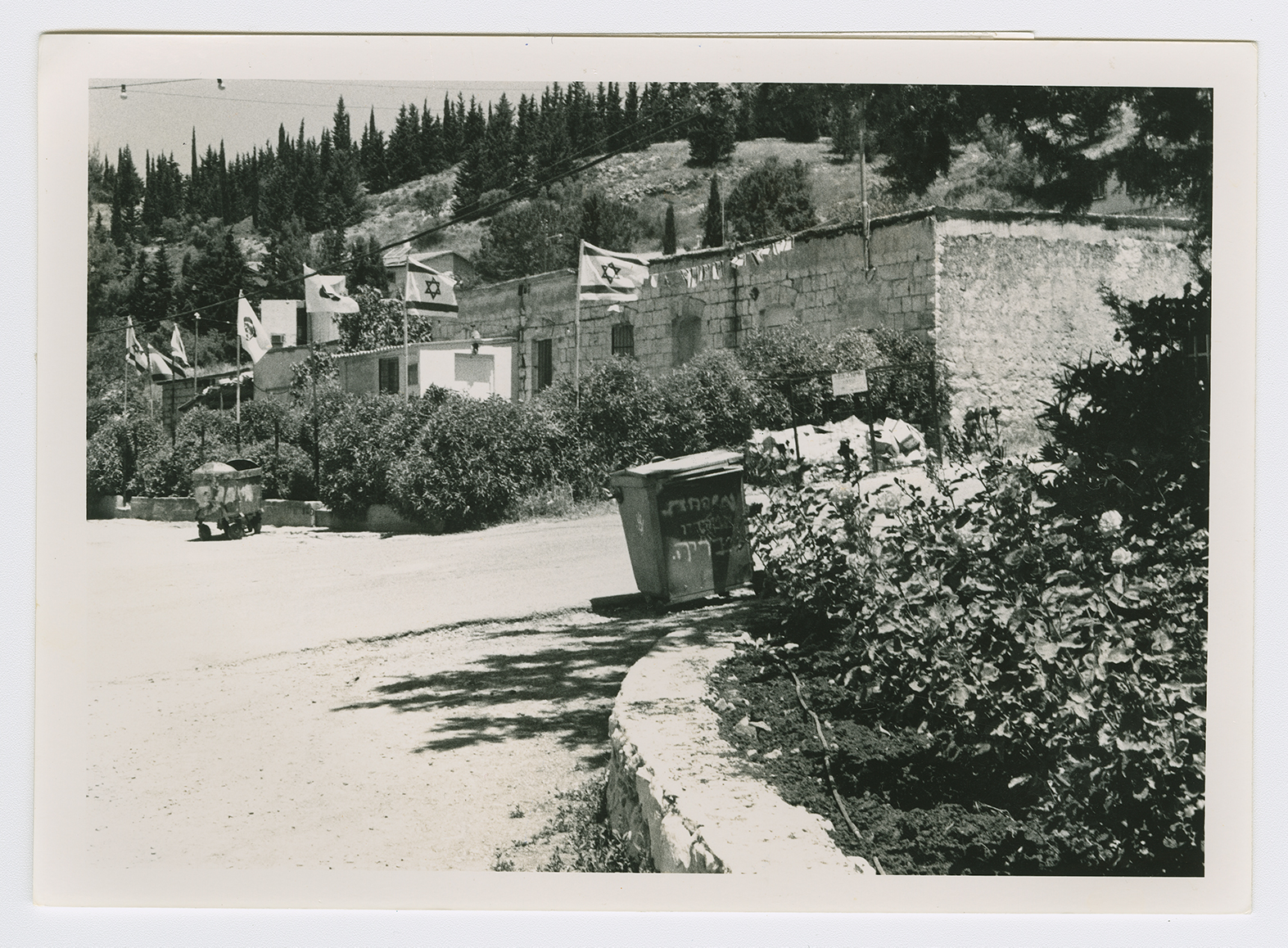
Zionists established a fortified settlement on the lands of the village in 1945 and named it Biriyya (196265). On 5 March 1946 British Mandatory authorities, investigating reports that the settlers had fired on a nearby Arab Legion camp, carried out an arms search there. After discovering weapons, they arrested the settlers and occupied the settlement. Ten· days later a mass of 3,000 other settlers marched up the mountain and tried to set up a second settlement, but the British soldiers drove them away. After continued confrontations the British released the settlers who had been arrested and eventually (7 June 1946) evacuated the site. It was taken over in September 1948 by a religious kibbutz. ![]()
About fifteen houses remain and are inhabited by the residents of the settlement of Biriyya; the settlement has been expanded to include the village site (see photos). In addition to the inhabited houses, four are semi-deserted or used for storage. Stones from destroyed houses can be found in some of the walls around the settlement. Many old almond, olive, fig, and eucalyptus trees are scattered throughout the site, mingled with trees that have been planted more recently