| Year | Arab | Total |
|---|---|---|
| 1931 | 339 | |
| 1944/45 | 490 | 490 |
| Year | Arab | Public | Total |
|---|---|---|---|
| 1944/45 | 21711 | 3011 | 24722 |
| Use | Arab | Public | Total | ||||||||||||
|---|---|---|---|---|---|---|---|---|---|---|---|---|---|---|---|
|
19365 | 3011 | 22376 (91%) | ||||||||||||
|
2346 | 2346 (9%) |
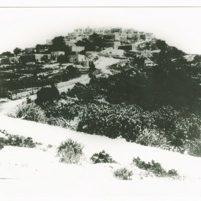
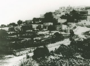
The village was located on a steep hill a few kilometers from the Lebanese border. It overlooked uneven terrain on the east and Wadi al-Bassa (which descended towards the sea) on the west. A secondary road, on which a good number of villages were also located, linked it to the Acre-Ra's al-Naqura coastal highway. Iqrit could be traced back to the Canaanites, who erected a statue on the site representing the god Melqart of Tyre. The Crusaders occupied it and called it Acref. Like other villages in Palestine, Iqrit was devastated by the events of the Crusades. It was subsequently rebuilt, and by 1596 this village in the nahiya of Tibnin (liwa' of Safad) had a population of 374. It paid taxes on goats and beehives and on its press, which was used for processing either olives or grapes. In the late nineteenth century, Iqrit had a population of about 100. The buildings in the village were made of stone and included a modern chapel. Situated on a tell, the village was surrounded by arable land, which the villagers planted with fig and olive trees.
When the British and French defined the border between Lebanon and Palestine in 1923, they included Iqrit in Palestine. Iqrit's population was made up of 460 Christians and 30 Muslims. The Greek Catholic Archdiocese built and ran a private elementary school in the village. Numerous crops were cultivated on its land, such as wheat, barley, olives, figs, grapes, and tobacco. In 1944/45 a total of 1,888 dunums was allocated to cereals; 458 dunums were irrigated or used for orchards, of which 80 dunums were planted in olive trees. Most of the land, however, was wooded with oak and pine trees. The tell over which Iqrit was built contained mosaic floors, the remains of a wine press, rock-hewn tombs, cisterns, and granite implements. Other archaeological sites were located in the vicinity.
The History of the War of Independence states that Iqrit was one of the villages captured at the very end of Operation Hiram, after most of northern Galilee had already fallen. In a scramble to seize the rest of the region, the Israeli army's 'Oded Brigade continued to advance along the road parallel to the border with Lebanon, taking Iqrit and Tarbikha on 31 October 1948. The account adds that the villages surrendered to the Israeli army, and the villagers apparently remained in their homes.
They did not remain there for long, however. Some ten days after the end of the battles on the northern front, they were summarily expelled. Along with several other villages, Iqrit fell prey to the 'principle of an Arab–less border strip,' according to Israeli historian Benny Morris. This was approved by the General Staff of the Israeli army in the second week of November 1948. At Iqrit, the soldiers told the villagers that their eviction would be temporary and that they would soon be allowed to return. Some were dispersed to Lebanon; others were trucked by the Israelis to the Palestinian village of al-Rama, some 20 km to the south. For some years there-after, and together with the inhabitants of several other villages that had received similar treatment, the people of Iqrit continued to plead with the Israeli authorities that they be allowed to return to their villages, to no avail. Morris writes that the case of Iqrit and two other border villages in particular illustrates how deeply rooted was the IDF's [Israel Defense Force's] determination from November 1948 onwards to create a northern border strip free of Arabs.'
The settlements of Shomera, founded in 1949, and Even Menachem, founded in 1960, are on the border between the village lands and the lands of Tarbikha, northeast and east of the village site. Goren, established in 1950, is on village lands west of the site. Gornot ha-Galil was established on village lands in 1980.
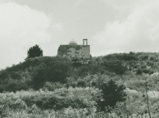
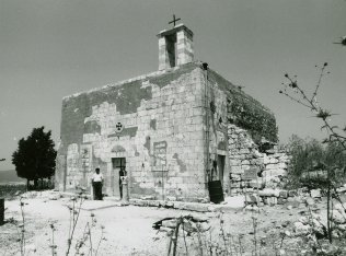
The only extant landmark is the Greek Catholic church—a stone structure with a flat roof from which a rectangular belfry rises. It has a rectangular doorway with a decorative round arch and carvings atop the lintel. An assortment of crosses is placed in niches of the front facade, including a cross above the arch and a large Latin cross on the (locked) door, flanked by two smaller crosses on the upper quadrants of the door. The church is untended and discolored. Otherwise the site contains nothing but stone rubble, and is overgrown with fig and pomegranate trees and other flora. There is a cow shed on village land.
Related Content
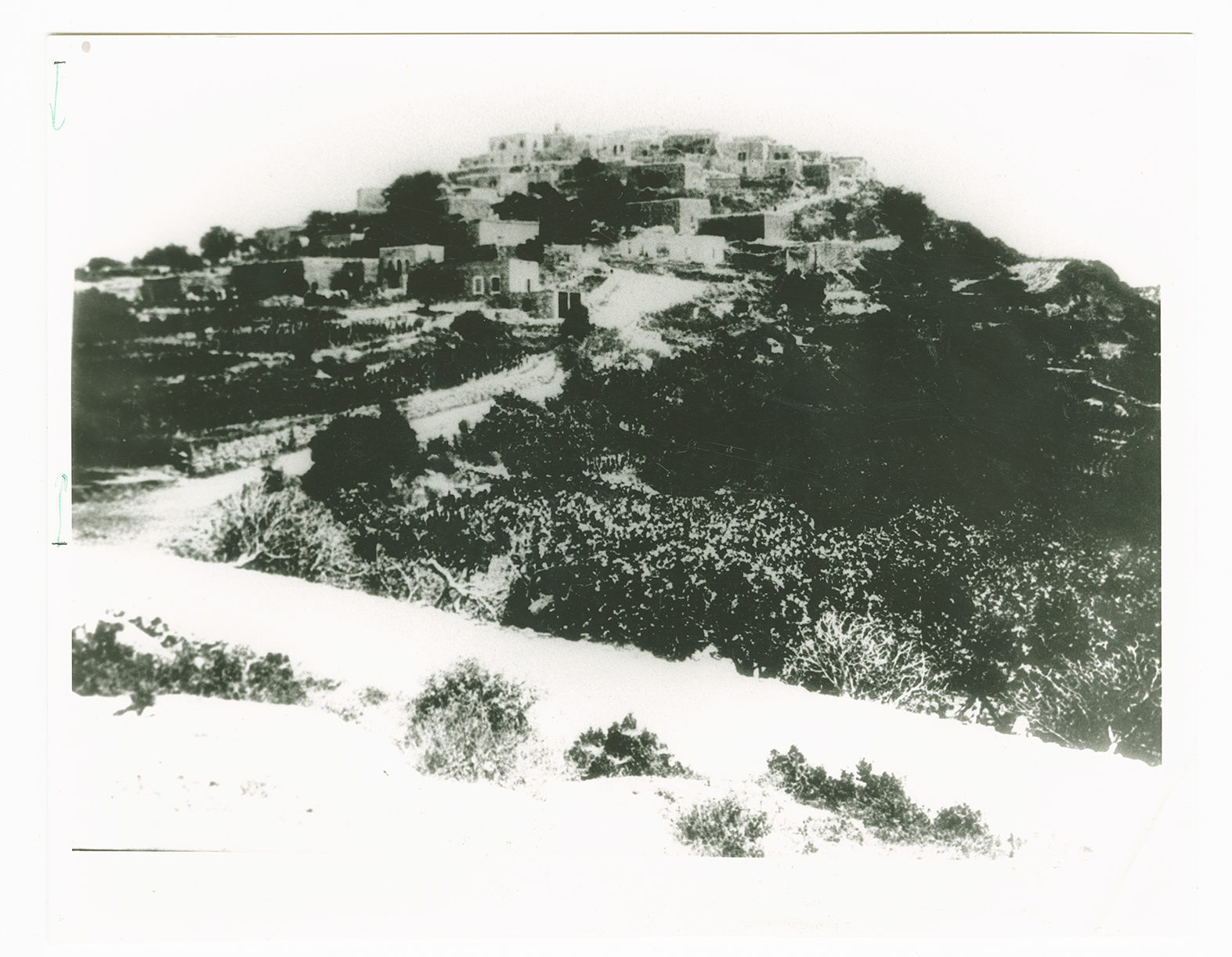
The village of Iqrit before its destruction. The belfry of the village church juts up above the other buildings.
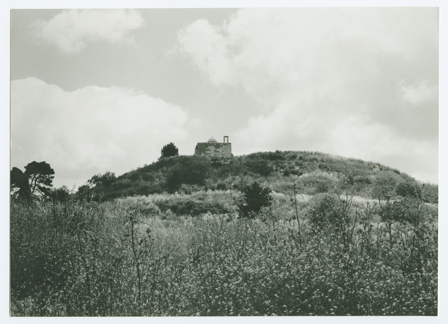
The church, the village's only remaining building, viewed from the west looking east.
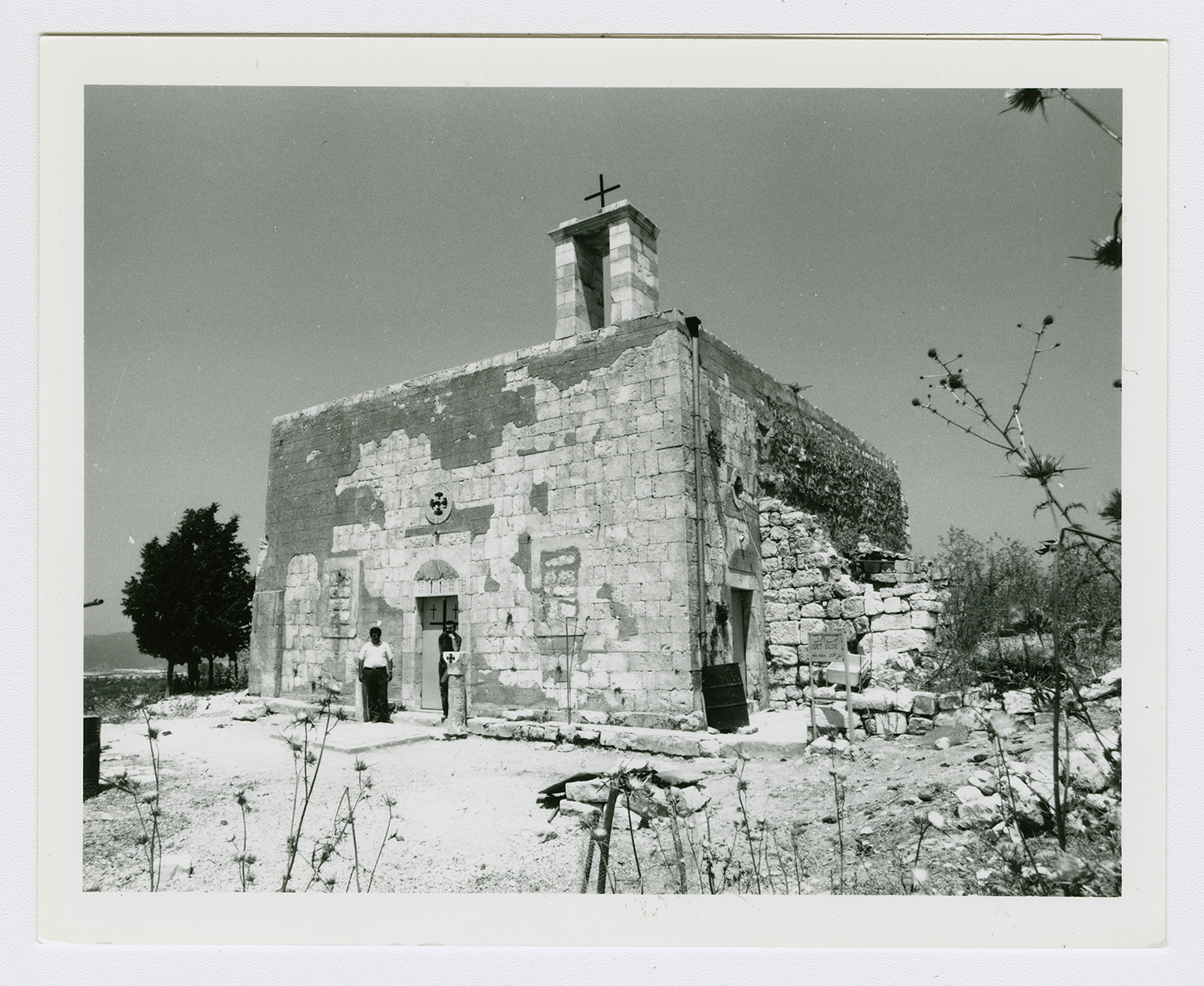
The church of Iqrit.
