| Year | Arab | Total |
|---|---|---|
| 1931 | 178 | |
| 1944/45 | 280 | 280 |
| Year | Arab | Public | Total |
|---|---|---|---|
| 1944/45 | 9349 | 112 | 9461 |
| Use | Arab | Public | Total | ||||||||||||
|---|---|---|---|---|---|---|---|---|---|---|---|---|---|---|---|
|
346 | 112 | 458 (5%) | ||||||||||||
|
9003 | 9003 (95%) |
The village was situated on a flat hilltop and overlooked wide areas on all four sides. Khulda lay close to a highway that connected Gaza with the Ramla-Jerusalem highway, and was linked by a network of secondary roads to Ramla and a number of major highways. It is identified with a locality that the Crusaders called Huldre. In 1596, Khulda was a village in the nahiya of Ramla (liwa' of Gaza) with a population of sixty-six. It paid taxes on a number of crops, including wheat and barley, as well as on other types of produce, such as goats and beehives. ![]() Robinson passed by the village in 1838; he described it as 'large.'
Robinson passed by the village in 1838; he described it as 'large.' ![]() In the late nineteenth century, Khulda was described as a large village built of stone and mud and situated on the side of a hill. The village had a masonry well to the west.
In the late nineteenth century, Khulda was described as a large village built of stone and mud and situated on the side of a hill. The village had a masonry well to the west. ![]() All of the people of Khulda were Muslims and maintained their own mosque. They drew water for domestic use from two wells, northeast of the village. They worked primarily in animal husbandry and rainfed agriculture, growing grain and small amounts of vegetables. In 1944/45 a total of 8,994 dunums was allotted to cereals; 9 dunums were irrigated or used for orchards.
All of the people of Khulda were Muslims and maintained their own mosque. They drew water for domestic use from two wells, northeast of the village. They worked primarily in animal husbandry and rainfed agriculture, growing grain and small amounts of vegetables. In 1944/45 a total of 8,994 dunums was allotted to cereals; 9 dunums were irrigated or used for orchards.
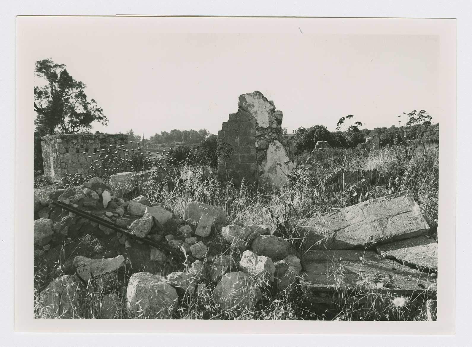
On 3 April 1948, at the start of Operation Nachshon (see Bayt Naqquba, Jerusalem sub-disctrict), a Haganah battalion occupied Khulda along with neighboring Dayr Muhaysin. Khulda was systematically levelled with bulldozers on 20 April, two weeks after its capture. The History of the Haganah says only that the village was taken 'without fighting.' Battles continued to rage around the village in later weeks, however, especially in the last week of May when an engagement around al-Latrun spread to the Khulda area, becoming what the press called 'the biggest Single clash of the war to date.' ![]()
Kibbutz Mishmar David (140136) was established in 1948 about 0.5 km west of the site, on village lands. Tal Shachar (140134) is nearby, 2 km south of the site; it is not on village lands. ![]()
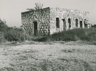
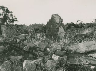
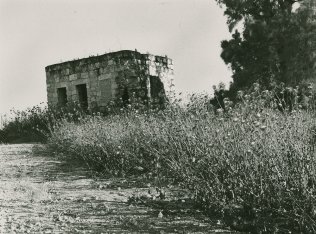
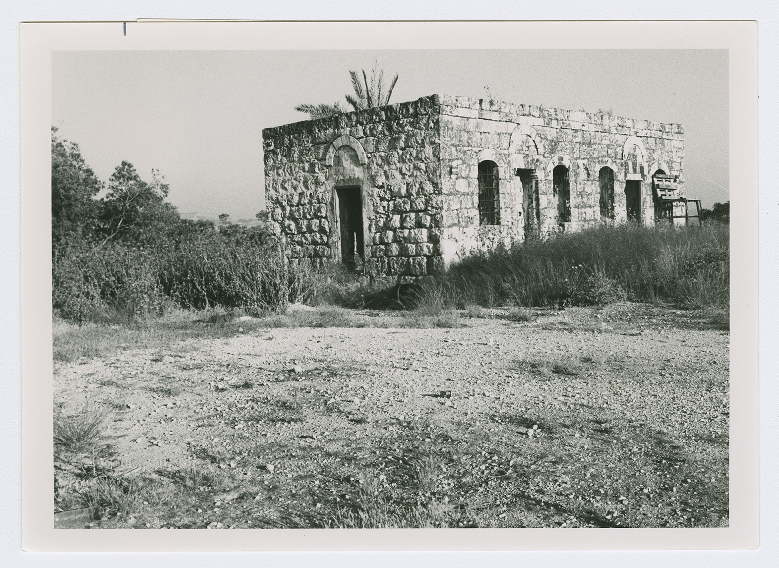
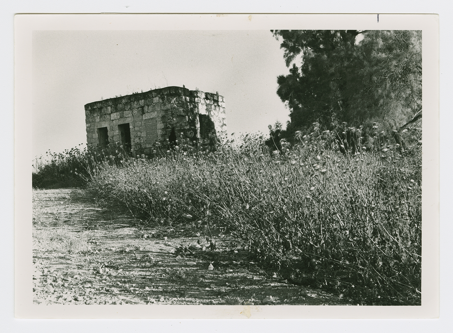
Only two houses are left. Between them the walls of two destroyed houses still stand; the iron braces that formerly supported the roofs are still attached to the brickwork. Otherwise, the site is covered with wild vegetation. Eucalyptus forests and carob and cypress trees grow around the site (see photos).